
Another winter storm is targeting Minnesota for a busy travel weekend
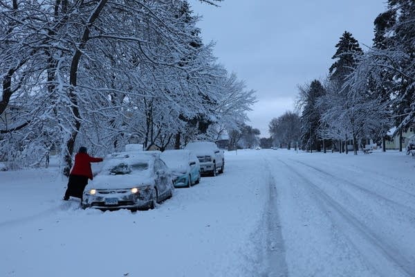
For the second time this busy holiday travel week, a winter storm is targeting Minnesota.
This time, the heaviest snow is expected in southern Minnesota, extending south into Iowa, southern Wisconsin and Illinois. It will start Friday night, and last all day Saturday – light to moderate snow, lasting for a long period of time.
Snow totals along the Interstate 90 corridor in southern Minnesota could exceed 6 to 10 inches, with several inches possible in the Twin Cities. Find forecast details on MPR Weather Blog Updraft.
Forecasters say Saturday could be a difficult day for travel across much of the region — and that people traveling home from Thanksgiving gatherings may want to wait until Sunday, to give snow plows a chance to clear the roads.
In contrast to the slushy, concrete-like snow that fell across much of central and northern Minnesota on Tuesday and Wednesday, cold temperatures mean the next round of snow should be light and fluffy. The wind will not be strong this time.
Following the storm, cooler air will move into the area on Sunday. Monday morning lows could drop below zero in much of Minnesota.
Forecast updates
-
SPLM news: Live weather blog and real-time radar
-
National Weather Service: Snowfall reports
Travel conditions
These state departments of transportation provide live updates on road conditions and accidents:
For bus and light rail riders in the Twin Cities, Metro Transit provides weather updates on its website Metro transit and Metro transit alerts Twitter pages, as well On its website.
Is there a snow emergency in effect in St. Paul or Minneapolis? Find out on City of St. Paul websiteor City of Minneapolis website.
Trip updates
If you plan to travel from Minneapolis-St. Paul International Airport or another airport in the area — or if you expect visitors to arrive by plane — airports offer online flight status updates:
Share this content:


Post Comment